For example, California dreamin’ wasn’t a thing — or maybe, in fact, it was — in the mid-17th century, when European explorers were just getting a fix on what would become, three hundred years later, La La Land.
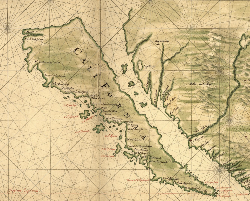
Joan Vinckeboons 1650 map of California. Geography and Map Division.
Spanish and Portuguese explorers had been traveling through Mexico and Central America for a century before the map was made, with Portugese-born João Rodrigues Cabrilho being the first to explore the coast of what is now California in 1542 and 1543, dropping anchor in San Diego Bay. They called it ”Alta California” and discovered that Native Americans had been living there for ages. Vinckeboons executed this map circa 1650, more than 100 years later, but still two decades before a permanent European settlement was established on the California coast, by which time they had learned that California was, in fact, not an island.
Still, by the early 18th century, the elite of Europe knew the planet’s broad, continental outlines, as seen in this map by one of the great cartographers of the era, France’s Guillaume de L’Isle.
You’ll notice that western part of North America is a squared-off blank, and that’s where our last map comes in, courtesy of the redoubtable team of Meriwether Lewis and William Clark. Below is an 1803 map that they used in the planning stages of their voyage.


Lewis and Clark’s map of the west, circa 1803, just before they set out. Geography and Maps Division.
In this close-up, you can see some of Lewis’ notations in brown ink. This detail is from what is now Canada, with Lake Manitoba to the right. The upside-down writing in the center reads, “the river that calls.” That was the English translation of its Cree name, Catabuysepu, and it was said to be haunted by spirits that wailed during the night, according to the journals of fur traders who worked in the region during the era. Today, it is the Assiniboine River, named for another Native American tribe of the region.

Lake Manitoba, Canada, lies on the right of the map.

The vastness of the unknown: “Conjectiral” (sic) on the early map of Lewis and Clark.
via https://blogs.loc.gov/loc/2020/01/free-to-use-and-reuse-maps-of-discovery-and-exploration/
Keine Kommentare:
Kommentar veröffentlichen